
WA Wheat & Granite Belt Holiday 2020
With all that had happened in 2020 with
Covid, by the time the end of winter had come, we really needed a holiday.
We don’t do crowds very well so we opted
for a quieter and less travelled route to explore a different part of WA. With
the timely recommendations from a couple who had travelled on the Eco Abrolhos
as guests and a bit of research from ourselves, we had a great route planned – travelling
East not North!
The plan was to start off travelling through the Wildflower Way, getting our fix on the winter blooms before heading further east through the Wheat Belt, past the Rabbit Proof Fence and onto the Granite Boulders before tracking SE to eventually end up at Wave Rock at Hyden.
All in all it was a fantastic trip; uncrowded, lots of interesting small towns, amazing natural landscapes & rock formations and a little over 2000 km’s travelled in total.


However it was the bird life that we spent the most time watching & photographing with many breeding pairs of Galahs and Black Cockatoos.


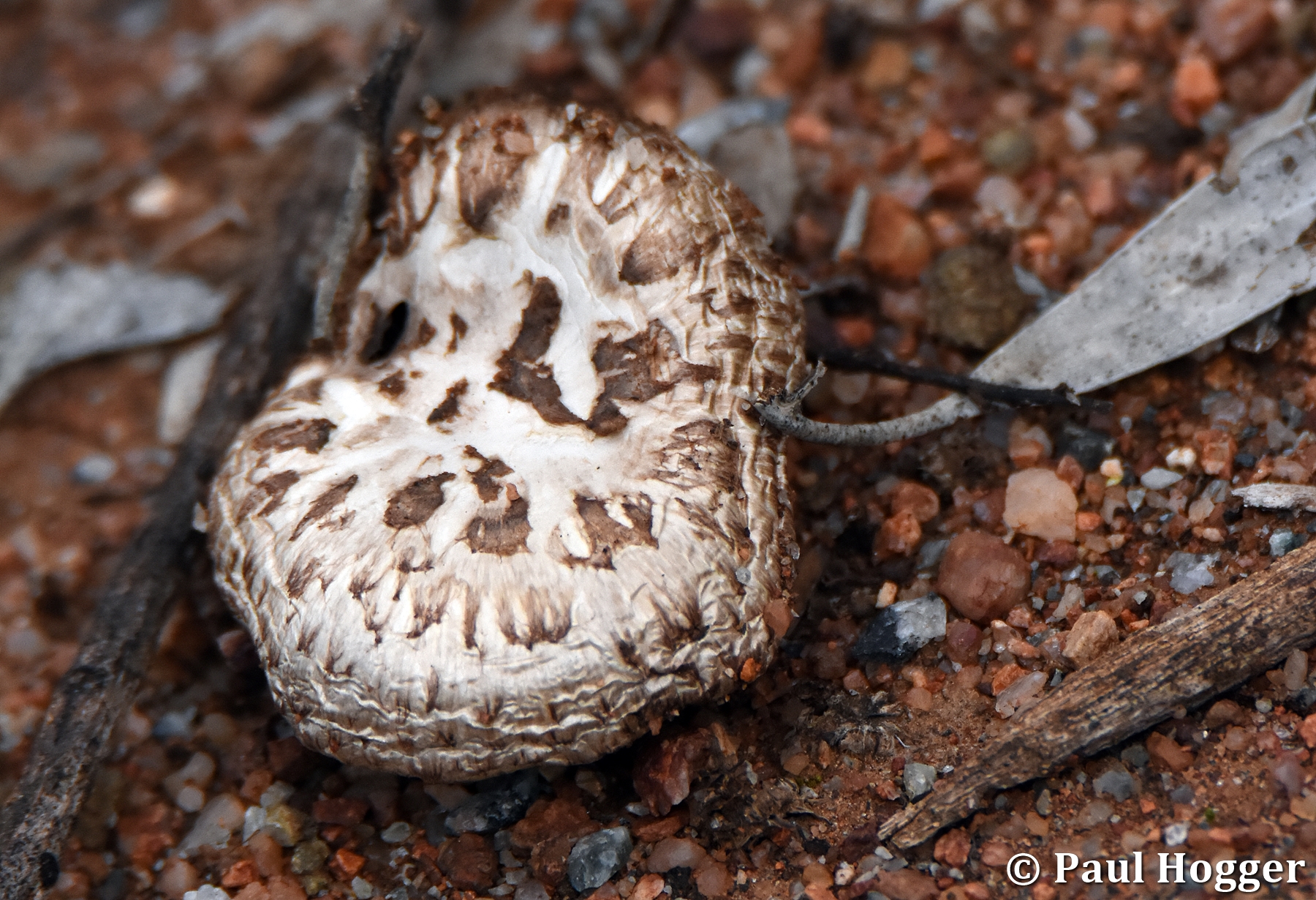
We drove down a side track and stopped for morning tea only to find the tree we were parked under had a massive bee hive within a fork that had hundreds of bees coming and going. Note the full pollen sacs of the ones entering the hive.


The outskirts of town had huge fields of Canola that where bright yellow in the midday sun.

In the afternoon we decided do a walk
around the town and follow the historical route. There were also loads of local
murals and a big pub.


The next morning we put the car into 4WD and
decided to explore the 3 nearby lakes. We expected to see more birds than we
did but we did see a few including Ducks, Avocets and Stilts.


We were surprised how close the fields were planted to the water’s edge and the views looking back over the Canola fields were terrific.


Further out is a working Talc mine. The mine has a great lookout made from the mine’s tailings and is a perfect spot for lunch.


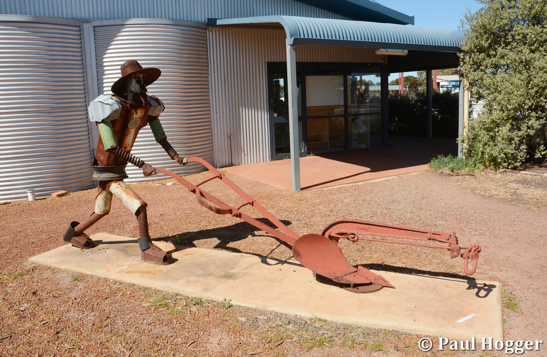
We had heard of a large Harley Davidson
Motorbike sculpture that a farmer had built in the corner of his paddock. It
was a bit of a drive to find it but on the way we stopped to look at some
amazing Canola fields lit up with the afternoon sun.


The bike was a lot larger than we expected and very cleverly built.


That night we had our first camp fire and toasted
marshmallows until it got too cold to stay outside.

When it was warm enough, we packed up camp and moved on but were not sure where we would end up staying for the next night.
Next stop was the town of Carnamah and a great place for morning
tea followed by an explore.


Just out of town there is a sheep farm and the sheep were right along the fence line.


There were huge Canola
fields on the opposite side.

Next we moved onto Coorow. Little did we
know that this quaint little town would see Paul working there over the coming
summer period as he was posted there for the CBH Harvest Season.

The town had an old Holden that had been turned into a flower bed and some great murals on the walls in the main street.


To exit the walk you have to drive on a one way dirt road that goes right through the community crops. It’s great to get so close to them with crops on one side of the road and magnificent everlasting wildflowers on the other.


Wubin is a tiny town with a big truck
siding and the gateway to some seriously good rocks and camping areas. We had a
funny little saying that was “Where the wuck is Wubin!”


There was already a campfire pit so we made
dinner and enjoyed a great fire with no one else around.

After a sleep in, a nice hot breaky and a
late pack up, we had a quick look around and decided Wubin Rocks would be a place
we’d like to return to on the way home and explore a little more of this
fantastic area.
We drove on towards Dalwallinu but about
half way there were forced to park up on the side of the road as firstly a
police escort, followed by a second escort and then finally two prime movers
carrying massive dragline mining buckets came past. They not only took up both
lanes but also a lot of the verge as well. In all our travels, it’s the widest
load we’ve ever seen on the roads.


At Dalwallinu we were able to visit the
tourist info centre which helped immensely in planning the next few days. We
were recommended to go and visit the Xantippe Tank walk, so that’s what we did
for the afternoon.


The walk around the tank was really good with
lots of orchids and even some new flowers for us. There were a few other
couples there also looking for flowers but they didn’t really have an eye for
orchids so we started showing a few where they were and they were very
grateful. The word spread and an hour later we were still playing orchid guide
and happily showing people where they were.


We climbed the rock above the tank and had
a look at the long thin dam wall that had been built to channel the water down
off the rock and into the tank.


There was a large Bob Tail Skink at the base
of the wall.


After the walk we motored onto Petrudor Rocks and drove past the popular walk and camp area and found a large area up higher that had magnificent views for a sunset and some nice wildflowers and trees all around. The issue was that the first place we picked, we hammered the first tent peg in and it only went in about 10cm before hitting solid rock. The next spot we found 20cm depth. Finally at the third attempt we found a patch where we could hammer all the pegs in full length. The tent was nestled into a great little place surrounded by flowering wattle trees.


We enjoyed a relaxing arvo of extended sunset
drinks and Paul chasing a curious little Red Capped Robin around with the big
lens. It took him over 90 minutes to get a decent shot.


That night he also did the first star trail
shot for the trip with a 150 minute star photo while we curled up in bed
watching a movie on what was a clear but very cold night.


In the morning we went back down to the
main walk area and did a walk up around the rocks. There were heaps of orchids
and great views looking down over the car park and further out to the farms and
fields. There were also a few pools that with the early morning lack of wind
made great reflection photos.


We left the rocks and headed further east
until we got to the rabbit proof fence. On the road was a Bob Tail Skink that we had
to stop for as it crossed and a dead fox that was strung up on a road
sign post that we just had to stop and have a look at.


Billiburning Rocks is about 40km north of
Beacon. On the way we stopped at Honeys Letter Boxes on the roadside that were
quite funny. Jim had a big part in putting this fun attraction. For our 2 teddies, it was the highlight of the trip!!


The rocks are great as you could drive
right around the base, camp at a few spots and walk all over the area. The
rocky structures are varied and the views from the top were mostly over bushland and
natural plains rather than the endless grain fields that we’d seen up until
now.


There was a lot of bird life around the base both in the trees and eating the grass seed and wildflowers.


We saw heaps of striped lizards sunning themselves on the warm rocks.


We vowed to return one day and camp there
for a few days as we thought the area was definitely worth a longer visit.
We returned to Beacon, packed up at the
caravan park and headed further east to Beringboading Rocks.
This place, like Xantippe Tank, also had a
large tank and a series of man-made walls that surrounded the rocks to
channel the water into the tank.


Just around from the tank was a Gnamma Hole
that had an incredible rock formation like a mini wave rock that went around
it. We photographed it from every angle.


Up on top of the rock platform are huge
boulders of all shapes and sizes and some that looked precariously balanced on
the rocky slopes.
The views from the top are fantastic and we could see both Billiburning Rocks and Elachbutting Rocks sticking out on the horizion.


As we were sitting at the rock cairn on the
summit, a hawk flew down and sat in the tree beside us. We couldn’t believe how
close it was.


On the way down we met another couple and
when we told them we were heading to Elachbutting Rock for a few days, they
told us about a small campsite that was right at the base of the rock and was
hidden within the trees and too small a track for RV’s and caravans. This
sounded perfect for us and when we arrived we searched for it and found it.
Thanks goodness they had told us otherwise we would never had gone that
direction as it was on the complete opposite side to the regular camp ground.

We set up camp in the little clearing and
had just enough time to climb up onto the rock to have a drink and watch the
sunset.


There are lots of other caverns and a few
walls that are also wave style rocks and nearly just as big.


Up on top is massive and had everything
from bare rock, many pools of water, amazing boulders and formation to areas of
dense growth, bushland and even a 4wd track at the end for those not capable
of walking up that distance.


Lisa decided during the heat of the day that one of the infinity style pools was too good not to have a swim in. She didn’t have any cossies but that didn’t matter…..


At one end there was an amazing looking valley so we stopped in the shade overlooking it to have
a drink when Lisa spied a very large Echidna running down from the top of the
rock to the base. We tried to run down and chase it but it was too quick and
despite seeing where it went into the bush, we couldn’t find it or its burrow.


Further along we found a series of arches
that had formed when the layers of rock were forced together and upwards.


Just as we were nearly back to camp Lisa
spotted a Harrier Hawk in the trees and further on a waterhole that had some
birds having a swim.


Overall this rock is super good and certainly
up there in the Top 5 with the other big walks we’ve done like Uluru (Ayers
Rock), Kata Juta (The Olgas), Kings Canyon and the Macdonald Ranges.
After dinner we watched a large rabbit in
the bush near our camp and had a camp fire and well earned drinks after sunset.


We certainly could have stayed a few more
days but reluctantly we pushed on and went 300km south to Hyden. On the way we
stopped in to Narembeen to have a look around and have a leg stretch. Sadly it
was Sunday and the town was all closed.


When we got to the caravan park at Hyden it
was full of A-Vans as it was the WA A-Van club’s annual meeting. We counted at
least 50 vans and were thinking the worst as Wave Rock is only a 200m walk from
the park. However they all turned out to be nice people who had all seen the
rock many times and instead had full day itineraries to do other things as a
group that didn’t affect us.
So in the afternoon we went 20km north to
an area called The Humps and Mulka’s Cave.
Mulka’s Cave is a walk through cave filled
with Indigenous Art. There are over 450 motifs including 275 hand stencils
making it the most significant rock art site in Southern WA.


Paul being a rock art enthusiast (and rock
art guide in The Kimberley), we spent heaps of time inside the cave with
powerful torches and cameras looking at the art.


Despite being late in the day, we decided
to do both the Gnamma Trail walk on the lower area and the Kalari Trail which
is steeper and takes you up to the summit of The Humps.
The Gnamma trail walk had heaps of fallen
trails all over the pathway from a recent storm and it was slow going walking
around the damage. However it was nice and cool in the dense foliage.


The Kalari trail on The Humps was very
different and out in the open. We walked up the large open rock areas and had
to navigate by following the small metal markers embedded into the rock.


On the way up we saw heaps of banded
lizards. Many were chasing each other at high speeds all over the rocks.


There were loads of unusual rock
formations, small wave rocks and lots of large odd-shaped boulders.


We were quite tired when we got to the top
but the views in the late arvo sun made it all worthwhile.


We got to the car just after sunset and had
drunk all our water bottles dry. Thankfully we had cold drinks and food in the
car. The upside was we didn’t see another person during both walks.

After a very good sleep and a big hot
brekkie, we were so excited to finally see Wave Rock. Paul’s grandparents had
given the family a set of Wave Rock placemats when Paul was a child so he was
fascinated by the photos. Finally he was
going to get to see it.
We thought it was fantastic. We were the only people there too, so Paul went
berserk with the camera.
He needn’t have bothered, as each time we went back over the 2 days, we were
still the only people there.


We moved on to the walk up to the peak
which looks down over the wave. There was another small wall around this rock
site which channelled water into the local dam that supports Hyden. It must work well because the dam was full.


We found more big boulders at the summit
area and on the way back down an area with scores of small cairns that people
had made from the shale rock in the area.


After lunch we went to the other highlight
of the area, The Hippo’s Yawn. We could
have driven there but decided to take the walk trail from Wave Rock to the
Hippo.
We found more cool rock formations on the way, some beautiful wildflowers on
the edge of the path and some birds that weren’t too afraid of having their
photo taken.


Once again we had The Hippos Yawn all to
ourselves.


On the way home we stopped for more photos
on the wave with different lighting from morning to afternoon.


Paul also ventured back there at sunset but
it was too dark on the wave so he climbed up to look over it.


Not to miss out on all photo opportunities,
Paul got up at 4am the next day and headed out fully rugged up in 4 degrees
with cameras and a tripod to capture the wave at dawn.


This was to be our turn around point on our
trip and we packed up camp and started to head back home but took a slightly
different route that took us past Bruce Rock and onto Kokobin Rock.
This is another really good rock to visit
but it has no camping facilities. From a distance it stood out from the flat
fields all around.

There are no roads around the rock so we
had to walk along the trail.
It was very pretty with lots of flowering
trees and we even saw an Echidna on the side of the track.


There were some wave rocks at this place
too.


The summit was a gradual climb and not too painful but it was worth it to see the great views spanning 360 degrees.


On the way down we took an alternate path
and ended up in a picturesque amphitheatre of rocks filled with large trees.


Fortunately we ended up coming back out
onto the main trail, cut about 20 minutes off the return trip and saw something
different.


By now we were starving and while we had
some snacks and food to cook for a main dinner, we didn’t really have any lunch
food.
So we drove onto the next town which was almost an hour away and called
Cunderdin.
As we were driving along we spotted a large old brick chimney that looked to be
part of a museum so we stopped for a look.

We couldn’t believe our eyes (or our luck)
when we looked across the road and there was an Ettamogah Pub.
These iconic pubs are a re-creation of the pub from a long running cartoon
posted in the Australasian Post magazine by artist Ken Maynard.
We knew there was one in Albury NSW and on the Sunshine Coast in QLD as we had
been to both and driven past them many times. However we certainly didn’t
expect to see one in remote regional WA. They are the only 3 ever built.
So we went in and had a great lunch in the
beer garden out the back.


Further along we stopped to have a look at
a bi-plane that was out the front of the local airport.


We were now heading back into crops and
fields and the canola along to road side made for some great contrasting
photos.


We had promised ourselves we’d return to
Wubin so that was our logical place to stay overnight before our big push to
get home the next day.
We decided to camp somewhere different but
had the same issues as Petrudor Rocks with solid rock being only a few cm’s
under the dirt and impossible to drive a tent peg into. Eventually we found a
spot and set camp.

As we were having a few drinks on sunset,
we heard rustling in the wildflowers quite close to our camp.
It turned out to be an Echidna that was crossing across the open area on dusk.
Lisa was super stoked and we managed to get some fun photos of her with it in
the flowers. We’d seen a few during the trip but not really good interactions
so this for Lisa was a real highlight and one we had hoped for but not
expected.


It was a loooong drive home but we decided
for a halfway stop at a favourite wildflower place for us at Perenjori which
has the ever popular wreath-flowers.


They were there but not as good as last year and there were loads of flies. We did however see lots of other great
flowers and trees along the roadside and also stopped in at the Perenjori
community garden which also has some great murals on the walls.


We got home just after sunset and incident
free. We really loved exploring somewhere new and it was a great 2000km road
trip – in peak season but without all the crowds.