
Lorelei’s Sailing Adventures

At the end of
Episode 51 we had just completed a 900 mile adventure with Paul’s parents
George and Chez on-board Lorelei as we sailed south-west through
The Kimberley from Darwin to Broome.
The Kimberley from Darwin to Broome.
We were just
sailing towards Broome as the Sun was setting……

Our location for this
Episode of the Blog.

Our route for this
Episode of the Blog.
We sailed
down the coast on the last leg with George and Chez.
It was a 90nm
run so we left at about 2am and were just getting into Broome as the sun was
setting.
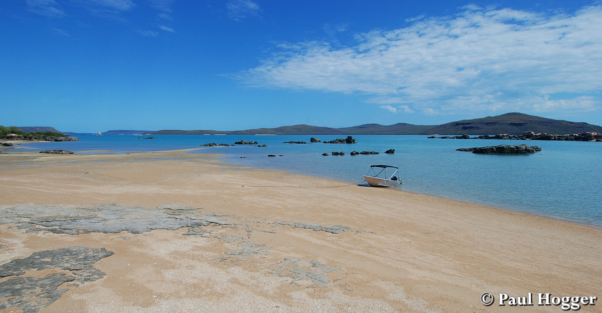
The biggest
issue is the main port faces SE-E so in the trade wind season the winds are
onshore and it’s very rough.
So all the boats
(both private and commercial) moor off Cable Beach which is on the ocean side
and offshore in the trades.
It’s exposed
to the Indian Ocean, rolly and far from perfect but there is no other choice.

Note the boats all
anchored off the corner of Cable Beach
We arrived
and noticed nearly every boat was on a mooring.
It was only
5m/16ft deep and we could see the sandy bottom so it had us perplexed.
That was
until we tried to anchor and found out the sand was only very thin and covering
the rocks & reefs underneath meaning the anchor would not grab & set.
We tried 3
times in different locations with failing light but to no avail.
We noticed
the charter boat True North leaving with a new group of guests so we called
them up and asked to use their mooring overnight.
The following
morning we took George and Chez ashore at Cable Beach.
They
organised a hire car and booked into their Broome accommodation for 4 nights.
Cable Beach
was crazy busy with 100’s (literally) of 4WD’s along the beach.
There was
anything from family picnics to sunbathers to cars launching boats of all sizes
to charter businesses and even buses.
Talk about a
super busy place.


Boat launching Broome
style – straight off the beach…..

If you drove along far
enough, you could still find a little peace and quiet.

Whale Watching the easy
way…..

The charter companies
had some great
tenders to get their guests to and from the beach
tenders to get their guests to and from the beach
The issue
with Broome is it is not set up for visiting boats and there is nowhere to
leave tenders and with tides up to 12m/40ft in height, that is a real
challenge.
For us it was
virtually impossible to have both of us ashore at the same time so we took it
in turns to go ashore.
We had a
strong wind warning forecast for 2 days’ time so we decided to get the most
important job of refuelling Lorelei done first.
We also found
out the moorings in cable beach were a ridiculous $50 per night which we
refused to pay. It gave you no services – nothing, just a buoy to tie to. We’ve
stayed at East Coast Marinas with full facilities for cheaper than that!!
So we took
Lorelei around to the port past the large commercial wharf.

The wharf
charges $300 to tie up alongside but the currents under the wharf are super
strong and many a private boat has done a lot of damage when trying to get back
off the wharf.
Additionally
we weren’t going to pay $300 for that privilege and spend hours rising up and
down along huge oyster encrusted poles.
So we anchored
off the town beach and George drove the hire car to go back and forth to the
service station with 20 litre jerry cans that we ferried in & out to
Lorelei using the tinny.
We could only
do it a few hours either side of high tide so we started at 4pm and carted 800
litres of fuel finishing after 9pm that night.
What a
mission that was!!!!!
Sure enough
the next morning the Southerly front hit with a vengeance and it was very
rough.

Roebuck Bay - the photo
doesn’t do it justice but Lorelei’s bow was dripping down below the waves
whilst on anchor
We tried to
move further into Roebuck Bay closer to land and it was OK at low tide but at
high tide it was terrible and we had no option but to ride out the night and
head back around to Cable Beach the next day.
Rather than
paying the $50 mooring fee we rang a friend Cody who we met in the Marina at
Darwin as his charter boat was berthed next to Lorelei.
He lives in
Broome and managed to find a mate whose mooring was empty so we took that.
Cable Beach has
some great sunsets and the whales were playing just behind the moored boats.


We met a nice
couple Grant and Glynis off the power cat Sea Wolf 2 and decided to link up
with them in helping each other with lifts to get to and from shore which
solved the dingy problem.
They would go
onshore in the mornings and we would do the arvos which was perfect.
It allowed us
to spend some time with George and Chez in the hire car to explore Broome and
to reprovision.
We liked the
town of Broome a lot. It was a clean, quaint place with very friendly people
and a lot of history.
The Pearling
Industry was the town’s biggest industry and a lot of the history and even
modern day industry & tourism centres around it.


An historical photo of a
Broome Pearl Diver
The old
Streeters Jetty is in the Chinatown area and has a lot of history.
It’s falling
apart and Mangroves have grown all around it now but the old photos show a much
different view.


Streeters Jetty in the
1980’s

Streeters Jetty in the
1970’s
We visited a
Museum that is restoring two of the old Pearl Luggers.


The shell not the pearl
was most sought after in the earlier days.
The Town
Beach has a memorial to the women and families of the Pearlers who would wait
for their husbands to return to the beach – if they even came back alive…

The
historical photos of the same beach looked very different to the present day
mangrove area.


Chinatown was
very interesting to walk around.
The Pearl
businesses and shops looked traditional and plain from the outside (so they can
withstand the Cyclones during the monsoon season) but inside they had
incredible fit-outs.

Outside…

Inside…
There were
also some fantastic art shops.


In the main
street is a Cinema that is the world’s oldest operating picture gardens.


The
commercial wharf looked a lot different from the land.

Like The
Kimberley, Broome has lots of Boab Trees.

Note the camels walking
along the side of the road to the left.

The other end
of Cable Beach closer to the town centre is beautiful and rated as one of the
world’s best beaches.
The foreshore
is well manicured and has a nice balance of parklands, restaurants & cafes.


Just before
sunset the beach becomes alive with people to enjoy the sunset, a camel ride or
to have a drink overlooking the spectacle.

Cable Beach Camel
Rides are a big attraction and we walked along with them on the water’s edge.


We then
enjoyed a cocktail before changing venues and having a fantastic seafood dinner
at a beach side restaurant.

Sadly that
night we said goodbye to George and Chez as they flew out the next morning back
to Darwin to pick up their rig and continue their travels towards the East
Coast.
We had been
together for over 3 months and had a wonderful experience together on both the
8000km road trip and the 2000km boat trip.
We had visited
4 states of Australia over the course of the adventure and it spanned 4 blog
posts (Episodes 48-51).
When they
left Broome, so did we.
Overall we
liked Broome but it’s a really hard place to visit by boat.
You would be
much better off to fly in or drive there.
We left on
the day of the spring tides and the currents were rocking up and down the
coast.
We had to
leave on the high tide and travel for 6 hours as the tide fell and pushed us
north, anchor and sleep for 6 hours, then go again, and again, and again…..
On the way up
the coast there were so many whales and we saw hundreds of them.
At one stage
we could see at least 6 at any one time and 360 degrees all around Lorelei.


At Beagle Bay
we anchored overnight and Sea Wolf 2 arrived not long after and just in time
for sunset.


On the fourth
travelling stint we passed Cape Leveque with its lighthouse and unusual cliff
edges.

We anchored
overnight off a beach that had a large area of ochre coloured sand.

After one
more 6 hour run with the tide, we arrived at Coppermine Creek and were excited
to see Sea Wolf 2 there as well.
We had sunset
drinks with them for 3 nights in a row.


At Coppermine
Creek we got stuck into the fishing and had 3 fantastic sessions.
On the first
morning we ventured right up to the end of the creek and found a small inlet
in-between the rocky shore and a sand bar at low tide so we drifted along it
casting lures.
We must have
caught over a dozen fish each and about 10 different species.
We let most
of them go and it was a blast on light tackle in only a few meters of water
depth.


At one stage
we looked up to see 2 Bush Stone Curlews looking down at us as we fished along
the steep rocky edge.

The next
morning we went fishing again but it didn’t go as planned.
We went to
the creek mouth at low tide and started there.
We were in
only 2 meters depth and on the first cast Lisa had something very big come and
take the lure just as she nearly had it back to the boat.
We both saw
its size so Paul packed the boat down for a long fight and we chased it out
into the bay.
It spooled
her reel right down to the knot 3 times with big powerful runs as it dived deep
in the bays deeper water.
Eventually 75
minutes later and 3km further out into the bay, Lisa had landed a whopping
16.2kg Northern Bluefin (a.k.a Long Tail) Tuna.
The most
amazing thing is she landed it on a small Daiwa 4-7kg bait-caster using 7kg
braided line, a 90cm 24kg leader and a Barra Lure!!!
Pound for
pound it’s probably one of the best fishing fights of her life and we are still
a little amazed that she landed it with no breakages.


Needless to
say, we gave up fishing for the session as Lisa was completely worn out after
the marathon battle and was a little shaky.
Paul didn’t
even get to have a single cast!!
After a relax
we went out again in the late arvo and had another session in a small pass
between 2 large bodies of water.
It was a lot
of fun with over 20 fish landed and released.
We even
caught 2 reef sharks on hard bodied Barra Lures!!
In between
fishing we explored the area and saw lots of bird life.


We motored
back to Lorelei just after sunset in the warm glow and glassy conditions.


After 3
fantastic days at Coppermine Creek, we took off towards Raft Point.
We had to
wait until 10:30am when the tide turned, then it was a race to see how far we
could get in the 6 hours before the tide turned again.
We had to
motor for the first half as we transited through the Narrow Coolan Channel past
the old BHP mine site with the unused wharf and ore loader.

The channel
narrows at the end and winds through a series of islands before exiting out
into a large bay.


The wind came
up and we had a fantastic sail across the bay.
We had to go
through a passage in the Kingfisher Islands and we reached them at 4:40pm.
The wind was
still blowing but the tide was slowing and light was failing so we stopped for
the night rather than attempt to arrive at Raft Point against the tide and in
the dark.
It proved to
be a great decision with a calm night and great sunset and sunrise.

The islands behind
Lorelei and the sunset with the warm glow on them

The same islands at
sunrise
When the wind
picked up again the next day we sailed to Red Cone Creek which was another 10nm
further past Raft Point.
We entered
the creek at 5pm and were anchored up in a fork where the creek splits into two
just in time for sunset.
It was mirror
flat and a very comfortable anchorage.
We were up at
5:30am to take advantage of the high tide at 7am to explore the creeks shallow
tributaries.
There were a
lot of Crocodiles but most were small and less than 2m/6ft length.

We fished the
washouts but only for a bit of fun as we knew it would be better fishing on the
low tide in the arvo.

We went right
up to the Sapphire Waterfalls but the water level was not quite high enough so
we decided to wait a few days for larger high tides to re-visit with more water
covering the mud flats.


In one
tributary we could hear some bird calls. Paul was able to mimic the call and
soon we had cute little Mangrove Robins in the branches next to the Tinny
exchanging calls with Paul.

In the
afternoon we went back to the same tributary to do some low tide fishing.
It looked
completely different at low tide with the waterway being much narrower, exposed
mud banks and oyster covered rocks.


There were
lots of Mudskippers hanging on the muddy areas.

We fished the
muddy washouts without much success but further up we found a series of rocks
in the centre of the channel with a lot of small bait fish around.
It looked
perfect and on the second cast, Paul had landed his first Kimberley Barramundi.
It was only
small at 55cm length but at least it was a start.

Less than 5
minutes later he landed a second one that was a slightly smaller 53cm.

With the
higher tides the next day (the tides were going 1 meter higher and 1 meter lower
each day we went towards spring tides..!!) we were able to transit up to the
Ruby Falls at the end of the southern arm.
The high tide
covered the Mangrove Trees and made for great photos looking into the sun
through them.

Ruby Falls were
excellent with lots of fresh water cascading down a series of waterfalls within
a stunning ravine lined with amazing rock formations.


The lower
pools are known to have crocs in them so we climbed up the rocks to the top
plateau and found a series of long freshwater holes that looked perfect for a
swim.


Paul took a
panoramic pic of the waterfalls and ravine on the way back down.

Just as we
were leaving we spotted a large croc sunning itself on the rocks.
It was the
biggest we had seen in the Kimberley and we were able to get very close before
it slid back into the water.


After lunch
we tried fishing again but the inlet that had the rock bar was so low that we
only had a 20 minute cast around it before we left for fear of being stranded
at low tide.
So we tried a
few other larger inlets and whilst they were very picturesque, we didn’t get
any fish. But we did get some bird photos and a nice sunset.

Sacred Kingfisher

Brahminy Kite

The next day
we tried to get to Sapphire Falls again and this time with success as the water
level was so much higher at the high tide.

It was nice
to go for a walk but it was a stinking hot 35 degrees and the waterfalls were
dry meaning the pools were stagnant so no swimming. Bummer!!!


Paul tried to
climb up a rock face to get a better view and brushed up against a large ant’s
nest in the trees.
He had ants
from head to toe and all over his camera backpack so it was a quick scurry down
for Lisa to help him undress and get them all off him.

As we walked
up along the plateau we passed a very small water hole and Lisa spied a 1m/3ft
long Freshwater Croc in the shallow stagnant water.
We were
amazed that he was living in such a small isolated and stagnant pond.
That’s the effect
on the poor wildlife by the lack of rain from the not so wet seasons of the
last 3 years.


We found an
easier path back down that had nice views over the inlet.

Paul had a walk
around the rocks casting lures at the end of the inlet and caught a small
Mangrove Jack.

At the lower
end of the inlet we stopped to go crabbing & fishing and Lisa turned our
freshly caught crabs into yummy Chilli Mud Crab.

On the day
before spring tides we left the inlet as the 12m/40ft tides that day would have
had Lorelei sitting on the bottom at low tide.
So at high
tide we motored out of the creek.
The wind was
NW meaning we could not sail up the coast to our next destination into the wind
so we stopped at Raft Point overnight and waited for the forecasted 20 knot easterly
blow to hit the next day.
The scenery
on the way was great.


The Kimberley’s version
of Uluru/Ayers Rock…
Raft Point is
a beautiful place and home to the best Aboriginal Rock Art we have ever seen.
(See our last blog post - episode 51).

The rocky
headlands surrounding the bay are stunning particularly at sunset and sunrise.
Paul took 3
photos of the same headland at sunset, just after sunset as the full moon rose
over it, and again at sunrise.


On the turn
of the tide we sailed up the coast.
We downloaded
the weather and it was still a 20 knot easterly forecast, so we were a little
perplexed when we sailed north to Deception Bay with westerly winds.
Go Figure..!!??
Go Figure..!!??
With the
tides advancing 1 hour each day we swapped from late afternoon passages to
early morning ones for current assistance but the downside was the lack of wind
in the mornings.
Fortunately
it was only a short 20nm run to Camden Harbour and we started with a nice
sunrise as we motored out of the bay.
Once again it
was a SE-E forecast and we had NW winds…???!!!


Camden
Harbour has some sad history as it was the first white settlement in The
Kimberley.
In 1865 a
group of Victorian sheep farmers loaded up a ship with sheep and supplies and
sailed to the harbour to establish a Sheep grazing property.
They arrived
in the middle of the monsoon season.
The boat
dragged anchor in a violent storm and sank, many people died of heat stroke and
the venture was doomed before it even began.
Most people
left on the next ship bringing supples but a small group decided to stay and
try to make it work.
By the middle
of the dry season most of the sheep had died from lack of water and Mary Jane
Pascoe died in childbirth making her the first white woman to die in The Kimberley.
The settlement was abandoned soon after and all that is left is a few remnants
on the mainland and Mary Jane’s grave which is on a small island named Sheep
Island.
We went to
the island and found the grave site next to a huge Boab Tree with engravings
dated back to 1865.

Next to the
tree and the grave we found a waterproof container that had laminated copies of
the history of the settlement, the recorded deaths of the settlers and some
drawings. It was a very interesting read.


We walked
around the island on the spring high tide and marvelled at the immense amount
of fish life in the clear water around the mangroves.
It was very
picturesque.


Note the Turtle swimming
close to the beach just next to the mangrove shadow
There were
also some great Boab Trees around the islands foreshore.
Unlike many
we had seen in dense bush growth, these were standing alone on the rock edges
and had unusual shaped trunk and root systems.


That
afternoon it went overcast and a storm came over the bay.
We were so
excited at the possibility of rain as we had not seen any decent rain for
months.
Sadly all we
got was a few drops but the cool wind and lower temperatures were a welcome
change.

We ventured
further NE towards our next big stop, the Hunter River.
On the way we
stopped at Ivy Cove to see the historical Boab Tree.
Ivy Cove is
in a narrow pass between 2 small islands that is notorious with current. Being
only 5 miles from Careening Bay and the famous Mermaid Boab (See Episode 51),
the charter boats choose to visit the easier to access Mermaid Boab rather than
stop at Ivy Cove.
The cove is
very picturesque and the Boab was huge.
It is
engraved by the crew of the “Ivy” a pearling boat that worked in the area in
the late 1800’s.

Across the
pass on the other island we spied a Boab that was sitting on a rocky point all
on its own.
We went over
and Lisa put Paul onto the rocky headland while she stayed in the tinny.
It is a
magnificent Boab Tree in excellent condition and no engravings.


As we rounded
the last corner and sailed toward the Hunter River, we spied a whale breaching.
It was a mile away further into the inlet and we had to sail past to clear the
headland before gybing and sailing into the bay.
The whole
time we could see it breaching.
As we got
closer, it turned out to be a mum with her small calf that appeared to have
only just learnt to breach and was having a blast doing it over and over again.
Mum would do
the occasional big tail or fin slap but it was junior who stole the show with
its endless breaches.
They didn’t
even know we were there as we quietly sailed close to them.


We sailed into
the bay until the run-out current finally beat us, so we stopped for the night
in a quiet side inlet and waited for the flood tide in the morning to take us
the last 20nm down the bay and into the Hunter River.
The tide was
racing in the next morning and we were motoring at low revs doing 8.5 knots.
On the way
Lisa spied a tall fin swimming alongside the boat.

A fin that
shape and colour is so distinct and is from our favourite shark, a Hammerhead.
It was a big one so we motored back around for
another pass.
We were
excited to have it swim right up alongside the boat and it was not scared at
all particularly considering the motor was running.


As we were
just about at the river mouth, we motored past Naturalists Beach which is a
popular spot for the charter boats to fly guests in and out using helicopters
from the Mitchell Plateau.
The small
cruise ship Caledonian Sky was there and we noticed 2 helicopters on the beach.


It was cool
to watch both helicopters leave together.

The Hunter River
is stunning and has some incredible rock formations along is entire length.


Within 2
hours of arriving we had the tinny in and were enjoying a late arvo fish up in
the smaller tributaries. It was amazing and we stayed until well after the sun
had set.


We went to
bed as the only boat in the tranquil river but the next morning it was like a
circus in the side tributary where Lorelei was anchored.
True North had
turned up and had anchored not far away.
They had 5
tenders running around fishing on the low tide and their helicopter was going
non-stop as they took the guests on scenic flights.
The larger
Coral Expeditions & Caledonian Sky were also out in the main channel and
together had 6 large RIB’s and one big tourist barge holding about 50 people
all going up and down marvelling at the scenery and spotting crocs.
The boat wash
and helicopter noise was just a little silly and we wondered how they saw any
wildlife at all!!!

We fished
anyway at a couple of rocky areas we knew held fish the day before and had landed
3 before we saw the 5 True North boats get one between them.
If they spent
more time with lines in the water and less time blasting every few minutes from
spot to spot then they might get something…..
Lisa landed
our first Threadfin Salmon in a gutter right next to True North and Paul caught
one 30 minutes later in a small inlet when the tide had risen enough to get
into it.


In the
quieter areas we found lots of crocs lazing on the mud banks in the morning
sun.


In the
afternoon the circus had left town and we were alone once again.
On the high
tide we did a scenic run up to the end of the tributary and marvelled at the
stunning scenery with its perfect reflections in the glassy water.


We had a few
casts around some structure for a bit of fun.
Talk about
scenic fishing at its best….


We also saw
some varied bird life.

Brahminy Kite

Common Sandpipers

Great Egret & Common
Sandpiper

Azzure Kingfisher &
Red Headed Honeyeater
We stayed
until sunset and the warm glow covered the rocky cliffs.


The morning
of day 3 in the Hunter had once again more boats in the inlet with Kimberley
Quest doing its helicopter flights and tourist runs up the inlet.
They don’t
fish so much and have a very friendly & respectful crew in their tenders.

We had a croc
hanging around Lorelei.
It was a big
one and swam round and round the boat.
We had
expected a lot of this in The Kimberley but after 10 weeks this was our first
one.

On the arvo
high tide we went out into the main arm and took a long run up to the end of
the river to the Hunter Falls.
We stopped on
the way to view some of the rocky cliffs on the water’s edge.

Like many of
the waterfalls in the Kimberley this year, these huge 40m tall falls were only
trickling down. It’s a rough and rocky walk from the end of the river so we
decided only to walk up the rocky dry river bed to the first swimming hole.


The wind was strong
and blowing along with us as we motored up the river so we were a little
concerned about the 8nm trip home into the wind with a run out tide.
Fortunately
we got out into the main channel to find the wind had dropped on dusk and we
had a relatively smooth trip home. Thank goodness!!
It wasn’t
only the late afternoons that produced the nice reflections, the morning
sunrises around Lorelei were also stunning.


For our last
day in the Hunter River, we did an early morning run in the tinny to the river
mouth, Naturalists Beach and the surrounding bays.
Originally we
had planned to take Lorelei there but the afternoon winds would have been uncomfortable
in the anchorage so we took the tinny instead and headed back as the winds
picked up.
The rocky
headlands marking the river mouth looked great with the morning sun.


Naturalists
Beach was beautiful and untouched. The only thing we found were helicopter skid
imprints in the sand above the high tide mark.

On the rocks
at one end we found Kapok Trees and it was interesting to see the trees with
all phases of reproduction from the buds, the flowers, the green seed pods and
the seed pods open with the Kapok Fibre exposed.


The beach was
great for a swim and we had fish, small reef sharks and Eagle Rays swimming
around us as we swam in the clear shallow waters.
The other
bays and beaches were just as nice too.


Whilst being
in the Hunter for a week, we had a pet Brahimy Kite that would hover around
Lorelei and pick up our food scraps we threw into the water.
It seemed to
be always waiting after meal times and we got lots of photos of it flying
overhead.


Our next stop
was to Rainforest Ravine which is about a 20nm run from the mouth of the Hunter
River.
We had read
about some amazing sea caves on an island 4nm from the ravine but they were
only accessible on a low tide.
Fortunately
we had a low at 2pm on the first day so we decided to try and find them.
There were 5
small beaches with lots of rocky headlands so it was hard to work out which
ones had the caves.


There were a
few holes and cracks that we checked out and we found one large cave system but
we didn’t think it was the one we were looking for.

Further along
we found a series of holes in the cliff, which turned out to be the right
location.
The cave
system was big with lots of smaller tunnels and chambers going in all
directions.


When we got
back to Lorelei we saw a charter boat had arrived and taken its guests to the
ravine so we were glad we made the decision to do the caves first and have both
places to ourselves.
The ravine
must be visited on a rising tide and that meant for us either right on daybreak
or towards sunset.
We decided to
beat the stinking hot 33 degree day and get in early.
So we left at
6:30am which would give us 3.5 hours at the Rainforest Ravine before and we
could return to the tinny at the same tide height.
The temp was
already 29 degrees when we left so we knew we were in for a hot hike!!
The start was
a clamber over the dried mud & river rocks before we got to a dirt trail
and sun protection from the trees.


We came
across the first waterfall and swimming hole and went for a swim.
We then
realised there were more and more waterfalls of all shapes and sizes about
every 150m along the water course.

The pools
were glassy on the surface making for some great reflection photos.


We walked up
a second water course off the side of the main one and found loads of lavender
flowers along the water’s edge and some interesting trees & ferns.


Getting back
to the tinny was a mission as the tide had risen and fallen back to where it
was when we arrived.
It meant the
banks had become wet and were now soft mud. We were sinking into it on every
step.
It was
impossible to get up onto the higher rocks due to a steep cliff face and the
going along the scattered rocks at the water edge put us at risk from the large
resident crocodile.
By the time
we got back we were covered in brown sticky mud with no way to wash it off
safely and we stayed like that until we got back to Lorelei.
Our last trip
in the ravine was to an amazing series of rock formations along the water’s
edge in a series of small bays within the ravine.
We called it
the lost city because it was like being in old stone ruins.


We called this one Teddy
Bear Rock….


Crocodile Head Rock….

With the
strong NW afternoon sea breezes prevalent almost every day, we took off early
from Rainforest Ravine, headed 32nm north to beat the wind and found shelter in
a small bay on the NE coast of Bigge Island.
The island is
large by Kimberley standards (hence the name) and the main reason for our visit
was to view the Aboriginal Rock Art.
When Lisa did
the research on Bigge, she found a lot of info on the Wandjina Art on the west
coast which is popular with both charter and private vessels.
However she
did find a small reference to some Gwion (Bradshaw) Art on the east coast that
deserved a little more research.
Sadly there
was not much info but Lisa did manage to get hold of a rough hand-drawn mud map
showing some art under a ledge.
Well that was
like a red rag to a bull for us and we set about finding this elusive Gwion
Rock Art.
We searched
for a long time and by 3pm we were hot, had stinging legs from the spinifex
grass and were dirty & dusty from crawling through caves and rolling around
in Wallaby poo!


We were just
about to give up when Paul had a thought….
A few months
back in Kakadu, we had gone on a guided rock art tour with a local ranger named
Christian.
He told us
the correct way to enter an Aboriginal sacred area is by talking to the spirit
ancestors – telling them who you are, what you are doing and ask for permission
to be there.
Most people
on the tour thought it was a bit weird but Christian was adamant it was the
right (and polite) way to enter an Aboriginal sacred area.
So Paul did
just that and when he was finished, he looked up there was a 2m long rock art
drawing of a fish within touching distance above his head.
It was vivid
and clear and to his left was a whole overhanging roof covered in rock art.

Paul had been
under the overhang for a few minutes prior and never saw a thing and now it was
all suddenly there and very apparent.
Lisa was up
above the ledge and climbed down to find Paul somewhat perplexed.
Needless to
say he was a little shook up from the experience and had to have a sit and
think about it for a while before taking the photos.


We walked
along a bit and found a second overhang.
It also had
art but not as much.
But what it
did have was a thin slab of rock that had split from the top of the main cave.
We could look into the split for meters in any direction and it was not
connected anywhere except for the edges.
How it was
still holding up was anyone’s guess and despite there being more art underneath
it, we had no intention of crawling under it.


On the way
back we climbed up to the top of the rocky area for a great view over the bay &
Lorelei just before sunset.

With the NW
winds we didn’t want to take Lorelei around to the Wandjini Rock Art on the
west coast so instead we got up at daybreak and did the 20nm return loop in the
tinny.
Fortunately
we woke early to an overcast but glassy day and the 10nm run there was smooth.

With a rising
tide and swell pushing onto the west coast beach, we decided to anchor the
tinny out and swim back out when we had finished.
It was a nice
beach with clear water so we figured it would be OK…wrong!!!
We got onto the beach to find loads of Turtle tracks from large females that were coming up to lay their eggs.
The tracks
were right down to the water’s edge at the low tide so we surmised that they
had only been made a few hours prior during the night.

What was most
disturbing was all the Crocodile tracks as well.
We saw one
turtle track that had done a big detour, then linked with a crocodile track and
there was a lot of sand messed up like they had a big fight. Fortunately the
turtle track continued to the water indicating it had survived.

It was a
little unnerving to have croc tracks that were only a few hours old and Paul
was going swimming when the tide was 2 meters higher!
It was
awesome to see the Wandjini Rock Art so close to the water’s edge as they were
in a series of caves just above the high tide mark.

The artworks were in
these caves along this rock face


The images of
the mouth-less Kaiara Spirits were excellent.

It was great
to see the art below in such good condition considering how close it is to the
beach sand. Sadly many of the other artworks in adjoining caves were badly
faded.


Lisa found a
high ledge in one cave that had lots of human bones and skulls.

It was cool
to see artwork of Macassan Trading Ships that used to visit The Kimberley to
collect Bech-de-mer (Trepang or Sea Cucumber) during the 1700’s.
It was painted
with an unusual green coloured ochre that we have rarely seen before.

The
Macassan’s would trade with the Aborigines.
Sadly some
things traded were tobacco and alcohol.
Could these
people in the artwork below be smoking tobacco pipes?
It’s the
first time we have seen this in Wandjini Rock Art.

We are no
experts in rock art but we have seen enough to know that there were some
unusual artworks with different styles that were from other eras or possibly
tribes.
This
“Descriptive Art” painting of a Saratoga’s body is different from the rest of
the art at Bigge Island.
Note the
addition of the white dots outlining the painting. Sadly the dots that made up
the head have mostly faded.

On the way
home we pulled into another small beach that had some great sea caves at one
end and some unusual shaped rocks at the other.


We walked up
the watercourse on the beach and found a large archway in the rock.


Morning tea
was at a tiny inlet that had clear water and a small beach with a weird free-standing
rock right in the middle.

That night we
were up on deck at 10pm marvelling at how clear it was.
We could see
the Milky Way from one horizon to the other and it was strikingly clear.
The black
hole was the most vivid we have ever seen it and it seemed like there were a
zilliion stars!!
We’ve had so
many awesome clear nights over the years in remote areas of the pacific but
nothing like this.
It was
interesting to note the UV index on our weather station was going off the scale
during the day with super high readings for the next week or so and we were
getting easily sunburnt. Our solar panels were also pumping in the power
greater than we have seen since they were brand new.
We were not
sure if it was a case of a thin ozone layer or something similar in the
atmosphere right above us at the time.
We later spoke
to another cruising couple who also said they had experienced the same thing.
We really
enjoyed exploring for rock art so we added a few extra stops over the next 10
days that gave us some more opportunity to see more art locations.
We chose to
head next to Dog Ear Bay & Swifts Inlet which were about 20nm east of Bigge
Island and on the mainland.
We got up
early to leave and Paul looked over the back of Lorelei to find a big croc
sitting only 1m from the stern.

It looked
really aggressive and when we walked around the deck, it followed.
Paul got game
and put the contour camera on a pole and put it into the water.
It came
straight up to it and Paul had to pull it out.
On the third attempt it came in again and as
Paul lifted the pole out, it jumped up and tried to grab it and bit the bottom
of the pole
It jumped so
high it hit the bottom of the tinny (which is 2m/6ft above the water), its legs
got caught in the crossed brace lines on the davits and it smashed into the
raised swim platform.
So we didn’t
try it again….
We named it
Cranky Croc! (Hunter J that’s for you….)

These are the
shots from the contour and the second one is taken just a second before it jumped
up. The contour has a super wide angle 170 degree lens and the camera was a lot
closer to the croc than the photos look.


The whole
irony of this croc experience was that we were away from the mainland & rivers
and out at an island that had nice bays, clear water and sandy beaches.
Considering
all the muddy & mangrove lined rivers we had just spent weeks in, it was
the last place we’d expect a cranky croc.
We’d caught
Coral Trout on the reefs only around the corner…..!!
The passage
to Dog Ear Bay was excellent – we were able to sail the whole way!!!! After so much motoring it was a welcome
change.

At Dog Ear
Bay it way really blowing hard so we waited until early morning to put the
tinny in and explore.
We had
another mud map showing some rock art locations on some small rock islands
around the corner.
It wasn’t
that accurate and we transited along some tight channels in the tinny before
eventually finding some rock art high up under a rocky overhang that we could
see clearly from the tinny.


We had spied
a large overhang on the other side of the island that looked like it had rock
art potential but it was up towards the islands peak and it looked impossible
to get up there through the dense foliage.
Paul tried
anyway and Lisa managed to put him ashore on the rocky shoreline while she
stayed in the tinny.
It took a
while but he managed to get up to the large overhang which had great views down
over the bay.


The first
thing Paul noticed was the floor of the cave was untouched and full of shell
middens indicating the aborigines used the area as a location for eating.

The walls had
heaps of different large rock paintings but many were faded.
There were
still 6 large ones that were clear and vivid.


Paul was very
excited as they were not on the mud map and we had not heard of anyone else
having seen this art.
The fact that
the area is very overgrown, remote, can only be approached at a spring high
tide and not near a recognised safe anchorage tends to suggest it is rarely
visited.
Paul may have
been the first person for a very long time to see these artworks.
We went
across to another location and climbed the rocks only to find a mangrove area
on the other side filled with shallow clear water that had loads of fish and
stingrays in it.


We walked
around the mangroves and searched in a few other locations but we did not have
any success.
The views
from the tops of the rocky areas were pretty good though.

We moved 7nm
that afternoon from Dog Ear to Swifts Bay.
The next
morning it was a glass out but already 31 degrees at 6:45am!
(It was the 1st
of September so welcome to Spring…)
We went
around into the southern bay to search for more rock art and scored big time!
With the help
of a single photo of a rocky headland from another yachts blog, we were able to
locate the area, park the tinny against a rock wall in the glassy conditions and
climbed to the site.

It was a
fantastic area and probably the most diverse amount of rock art we had ever
seen. There were many areas and probably over 100 artworks of all colours and
sizes.


This artwork of a person
was about 2.5m/8ft long


Note sure what this is
but it looks like a 10 fingered monster (or alien or prehistoric animal) with
some big teeth
It was
interesting to see white artwork on the black rock.


We found
cooking fire pits, shell middens, areas where they made the ochre for the
paintings and even burial areas with human remains.
It was a
complete living area and if you could only visit one Aboriginal art site in The
Kimberley, then this would be it.


If you were
wondering what Paul goes through to get the artwork photos then these photos
below tell the story as some of the best artworks are in very confined spaces.
He was hot,
covered in grey dust & Wallaby poo and had minor scrapes & scratches
from getting in and out.
Thank
goodness we have a good washing machine and unlimited water….


We found a
small Perrenti in the rock art area.

Bush bashing
and rock climbing is always fraught with a little danger and sooner or later
minor accidents happen.
On the way
down, Paul rolled his ankle which sidelined him for 36 hours.
He was bored
after 4 hours rest and ended up making Sushi and did short stints of cleaning
the boat, before getting roused at by Lisa to lie down and put his foot up.

When the swelling
and pain had gone we went to a nice beach on the side of Swifts Bay to see how
the ankle coped with a walk on the sand.
The sand
turned out to be mostly coarse shells but it was still walkable in bare feet –
just.
The beach was short and steep and had lots of unusual shaped rocks on the spit separating the 2 bays.
The beach was short and steep and had lots of unusual shaped rocks on the spit separating the 2 bays.


We managed to
have a swim in a protected corner and there was a rock ledge as a bonus to
provide shade.


With the test
passed, we strapped the ankle and put it into Paul’s new Scarpa hiking boots so
we could do some more rock art exploring.
We had seen a
large rock standing alone on the ridge top overlooking the bay and appeared to
have an overhang going right around it.
We surmised
it would be a potential spot for rock art so we tied up the dingy at a nearby rock
ledge and headed towards the hill.
On the way we
found some other caves and did a few detours to explore them.
We didn’t
find any rock art on the overhangs facing the bay but we went a little further
back into the hillside and found a second line of caves that had Gwion/Bradshaw
art in them.


We had to go
back down to the rock shelf along the water’s edge to traverse across towards
the big rock.
We came
across a rock cairn and saw a path up the slope through the spinifex grass
indicating there must be something good up there worth seeing.
There were
loads more rock cairns on the way highlighting the trail and we were getting
excited….

The rock was
awesome with a large overhang the entire way around.

The entire
roof of the overhang was covered in art and some were massive.
The only
issue was a lot had faded and there were many artworks that were painted over
the top of each other and in places it was a jumbled mess of mixed art making
it had to decipher and even harder to photograph.

Note the whole floor of
the overhang covered in shell middens
There were
lots of ones worthy of photographing though.


This artwork was about
4m/12ft across and Paul had to lie on the floor
and photograph it with a 10mm fisheye lens to get it all in.
and photograph it with a 10mm fisheye lens to get it all in.

This is a 2.5m/8ft long
Stingray done in white ochre

Right: Not sure if the
holes in the rocks were supposed
to be the eyes but the effect is great
to be the eyes but the effect is great

These 2 figures were
over 2.5m/8ft long.
The bottom spirit was
faint but had an incredible Kiara
head with the smaller heads all around.
head with the smaller heads all around.
That
afternoon we were inside and felt a cold wind come over Lorelei.
We went
upstairs to find a fantastic looking storm highlighted by the setting sun.
It was behind
Lorelei meaning it was downwind but it appeared to be getting closer.

A look at the storm from
down both sides of Lorelei
Sure enough,
just after dark the boat swung around 180 degrees and we had rain!!!!!
It was soooo
awesome and the first real rain we had seen in over 4 months.
We were
running around in the rain like little kids…..
It was the
first time the new tinny had seen rain and the salt rinse off was so welcome.
Despite the
stormy night, we woke to a clear day and a clean boat!
It was still
blowing light SE winds which was perfect for our next leg which was a long 50nm
day sail to round Cape Voltaire and back into the next bay.
We took off
for a big days sailing and we went from SE winds to nothing then to NW by the
arvo so it had a bit of everything including a few hours motoring in the
middle.
We arrived at
the north side of Port Warrander and tucked into a protected bay from the NW sea
breezes and hoped we didn’t get another SE storm overnight.
The headland
in front of Lorelei was lined with loads of Boab trees all along the rocky
foreshore.
The next
morning we crossed the bay in the Tinny to go and view the aboriginal art which
was reported to be on the rocky areas behind 2 sport fishing camps.
We arrived at
the bay to be greeted by the camps owner and were politely told the area was
privately leased from the Aboriginal owners and the rock art was not be viewed.
So we struck
out on that one and decided to do a scenic tour around the bays beaches and
headlands on the way back to Lorelei.
We found an
interesting beach covered in drift wood at the high tide mark and above. It
covered the entire length of the beach.

The Boabs
just back from the beach were huge and most were standing alone overlooking the
water.


We went to
the headland near Lorelei with the grove of Boabs but it was low tide and the
sun position was wrong for photos so we went back at 4pm to view them as the
sun was setting behind them.
The sizes
ranged from fully grown right down to only 1-2m/3-6ft tall.


We found a
small one on its side and it was starting to shoot branches vertically off the
main trunk.
It’ll look
awesome in another 50-100 years…..

With the
recent rain, some of the Boabs were already starting to spout leaves in
preparation for the coming wet season.

The next day
we were going to leave but there was no wind and it was stinking hot.
It was 35
degrees outside and 37 inside Lorelei by 11am!!!
The wind
never eventuated and by 2pm we aborted and stayed for another night.
So instead
Paul rigged up his time exposure camera, tripod and timer and we headed into
the Boab headland for sunset along with a picnic dinner and Paul’s camera to do
a star trail shot.
The sunset
turned out to be great and Paul used another camera set-up to do some Boab post sunset photos.
He was very,
very happy with the results.


After a lot
of planning and tests, Paul had found a suitable Boab for a star trail shot.
The camera had to face due south and then we had to take into account the moon
location and our illuminated picnic area.
It took two
hours to do the shoot using nearly 200 images, some using a flash and others
with Paul manually light painting.
The combined
results turned out pretty good.


By 10pm we
were done and packed up but ran into bit of a problem as we had a crocodile
stalking us every time we tried to come off the rocks, cross the beach and get
to the tinny, particularly as we had 8 bags of gear which required 2 runs to
get them into the boat.
Eventually we
managed to get all the gear and us into the tinny safely – just…….
We moved on
to the Osborn Islands but the short 17nm run from Port Warrander was a bit of a
stressful one as the channel through the Osborn’s is packed with Pearl Leases
operated by Paspaley Pearls.
The leases are
right in the middle of the channel and skirting around them sometimes put
Lorelei into very shallow water and at times with barely inches under the keel.
At one stage
we had to cut the corner and skim the leases or we would have run aground!!
We spent 3
days within the island group exploring, crabbing and fishing.
We were
experiencing very hot days of up to 36 degrees and afternoon storms.
It was
early-mid September and the monsoon/wet season was creeping up quicker than
expected.
We started
our daily activities at 6am to escape the heat.
The first
place to explore was a location called the Three Arches.
The beaches
surrounding the arches were picturesque with loads of rocks in the water
providing wind and swell protection.
The aches were
huge and much bigger than we expected.


The caves off
the side of the arches were also large and we even found a small amount of
Aboriginal Rock Art there.


In one cave
we found shell middens and unusual shaped bones or an exoskeleton that we
thought may be from a turtle.

On the higher
tides we explored 2 shallow creeks further into the bay.
One creek has
a large rock formation called “The Castle” with a very large series of
catacombs running through the rocks.
There were
scores of pathways running in all directions and varied in length from only a
few meters to over 50m long tunnels.

Paul didn’t
take his tripod so long exposures balanced on rock ledges had to suffice.


There was a
lot of Rock Art under the ledges around the outside of The Castle.


We found some
unusual golden coloured trees and some others with huge amounts of sap seeping
from the limbs.

We ventured
further up the creek on the high tide and could even see rock art from the
tinny under large overhangs behind the mangroves.

On the way
home we spotted a Jabiru running around on the sand spits doing its dance with
its wings out.
We couldn’t
get any closer as it was too shallow for the tinny.


The next
morning we ventured around to the exposed side of an island to view what is
reported to be the largest Boab Tree in The Kimberley.
We had to
trek through Mangroves and slippery rocks to get to it but it was well worth
it. It is huge!!! We’ve seen other Boabs
dated over 1000 years old and they are less than half this one’s size. Could it
have been around since BC?

The tree was as deep as
it is wide in the photo
We found 2
large Boabs on the other side of the island that were standing alone on a rock
ledge overlooking the passage between 2 islands.


Around the
back of the island was a huge rock pile that went from the water’s edge to the
summit.
The long
rocks we strewn in every direction and most had an unusual hexagonal shape to
them.


We had an
interesting sunset that night with the clouds but unfortunately no rain.

For the next
few days we travelled with most passages between 30 and 50nm daily before
stopping overnight.
It was neap
tides but we still had to deal with strong currents in many areas and most of
the travelling revolved around tide time to get the current assistance.
We stopped at
Freshwater Bay and decided to stay 2 nights and have a travelling rest day so
we could tidy up, do the washing and a bit of spring cleaning.
For the next
2 days the wind blew and we took advantage of it with 2 large day passages.
The first day
we sailed most of the way and the second day we sailed 50nm from door to door
and only turned the engine on for anchoring.
The passage
was around the infamous Cape Londonderry which is always rough and the water is
brown with the strong current and churned-up water.
We were lucky
to have reaching winds and current assistance and we rounded it with no problem
– unlike the passage down 3 months ago when it was windy and rough with big
seas as high as the davits.
We arrived at
Glycosmis Bay and decided the small bay to its north would have better
protection from the 20 knot NW winds.
It was only a
small and shallow bay but we snuck in ok.
As we were
about to drop the anchor Lisa spied what we thought was a rock in the centre of
the bay.
That was
until it started moving - it was coming towards us.
It turned out
to be a massive Crocodile and by far the biggest we had ever seen in the wild.
It swam right
up the side of Lorelei and was looking up at us from only a few meters away.
We were
looking at our tinny on the davits and back to the croc and the croc was way
longer and we estimated it to be well over 5m/16ft long.
Its tail was
huge!!!
We had been
quite blasé about crocs so far as most had been small with the occasional
medium to large one but not like this huge thing!!
Unfortunately
the cameras were packed away downstairs.
We had to be
very careful the next morning when putting the tinny in and setting it up.
We had a nice
sunrise before exploring the southern bay.

The southern
end was amazing with a big cliff face that surrounded a small bay.


We sounded around
trying to find a path in for Lorelei but it was just too shallow.
We explored
some other beaches and bay in the area too.

We had
planned to visit the King George River and possibly the Berkeley River too but
after looking at the weather and tides we just couldn’t make it work.
We threw 20
different scenarios around but nothing would work unless we crossed the bar at
the Berkeley River and were prepared to stay up the river for 11 days.
So with
favourable winds, we left The Kimberley and tackled the 260nm passage to
Darwin.
It was a slow
passage but we sailed most of the way (albeit zig-zagging down the rhumb line
to cope with the wind direction changes) and arrived safely in Darwin harbour
in 64 hours.
So that’s a
wrap for another Episode of our sailing adventures.
It’s been a
great experience during our 3 months in The Kimberley.
We are back
in Darwin but it’s so damn hot already and we are a little concerned about the
coming wet season and the cyclone risk in the top end. If the temperatures are
anything like the end of the last wet season, then we don’t want to be around
for that.
We’ve got to
hope the monsoon season doesn’t kick off too early……
We have only
put a small amount of The Kimberley Boabs and Rock Art photos in the blog
Episodes and there are loads more photos in the “Aboriginal Rock Art” and
“Boabs Trees” folders which can be accessed via the top tabs back at the top of
our blog home page.
Enjoy!!!
Paul and Lisa
Hogger
Yacht Lorelei
Safely back
in Darwin